|
|
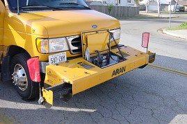
| Figure 1. Roadware ARAN survey bar |
Roads are prioritized for maintenance as a result of pavement inspections.
The cost of frequent, comprehensive inspection is high, and many jurisdictions
limit their surveys to major roads, while minor roads are surveyed in 3-year
cycles. Roads are inspected by experts who characterize the Pavement
Condition Index (PCI), based on established physical parameters such as cracking,
rutting, raveling, etc. Over the past decade the task of pavement health
survey has been facilitated by vans (Figure 1) that capture exhaustive photographic
and video logs of pavement quality (and at the same time asset inventory),
while recording road geometry with GPS and Distance Measuring Instruments
(DMIs). This produces a detailed and georeferenced condition report, with
PCI ratings for every ~10 m section of road. Nevertheless, this remains an
expensive and troublesome survey, while cost ("stitch in time") and safety
considerations require that it be done at regular intervals.
|
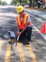
| Figure 2. Measuring pavement cracks. |
Pavement health surveys may also be used at a more synoptic level, for example to assign maintenance funds to local governments.
If remote sensing is to ease the burden of pavement health surveys, we
must be able to find a correlation between remotely sensed parameters (e.g.
spectral reflectance) and physical parameters such as cracking and rutting.
Hyperspectral sensing can easily distinguish between concrete and asphalt.
It can distinguish between various mixes of concrete — those used on bridge
decks versus those used on tennis courts. It can distinguish between asphalt
coatings used in parking lots versus regular road surfaces. It can identify
specific minerals in the pavement, and can over a series of observations
signs of exposure (oxidation) and use (oil drippings and tire rubber from
vehicles, particularly around intersections).
|
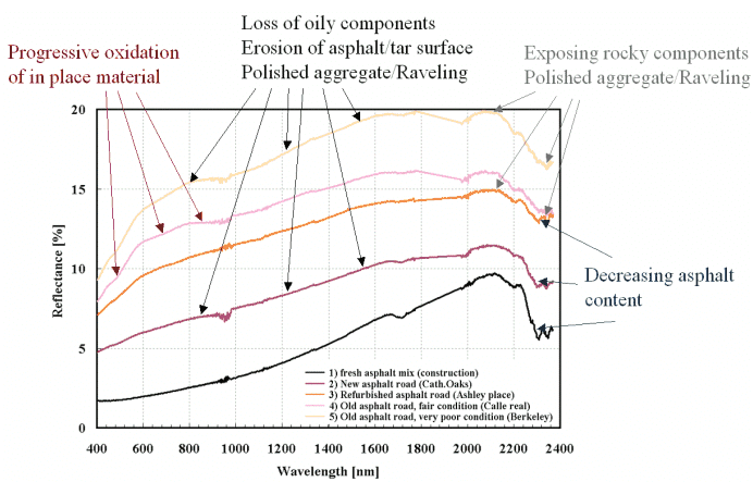
| [Click to enlarge] Figure 3. Pavement spectra lighten with age. |
Until recently the best hyperspectral data available were taken from JPL's
AVIRIS platform, with spatial resolution in the 3-5 m range. Private firms
such as Spectir Inc of Santa Barbara now offer sub-meter hyperspectral imagery.
At these resolutions a sensor is unable to "see" individual cracks and ruts,
but it is able to detect broad differences in materials. Older roads are
distinctly lighter (i.e. higher reflectance) than newly paved surfaces (Figure 3), therefore
we are able to estimate age/degree of exposure. However, when it comes to
physical parameters of interest to pavement managers, based on analyses performed so far,
we have been unable to establish beyond doubt that the variances between
pixels are due entirely to differences in road composition, as opposed to
routine data "noise."
The project is still in progress. One obvious conclusion is that
the spatial resolution of airborne sensors (1-4 m) is insufficient to measure
specific physical parameters such as cracking. Furthermore, the relationships between sensed surface materials and pavement
health are not easy to establish — for example, bond strength is not apparent:
a surface recently treated with chip seal could have a signature very similar
to one where raveling has exposed the aggregate.
There may still be a role for airborne spectral sensing at the synoptic level. Truck mounted spectral
sensors might produce better results at close range, but given the array
of other sensors on the truck, the challenge for spectral sensing is to offer
additional insights, better, faster or cheaper.
The broader issue is that pavement health estimation is a complex science/art.
There are about 40 different physical pavement properties in the standard
pavement condition rating manual (ASTM D6433). Some of these refer to visual
characteristics, while others address subsurface conditions that spectral
sensors do not see. A likely role for remote sensing in the short term is
therefore not to replace the field inspector, but to assist the inspector
with insights into subsurface conditions (by ground penetrating sensors),
drainage and environmental/historic aspects that cannot normally be evaluated
except with laborious and destructive testing. This will require a battery of sensor types and expert systems.
Val Noronha, noronha@geog.ucsb.edu
Dar Roberts, dar@geog.ucsb.edu
Omar Smadi, smadi@iastate.edu
University of California, Santa Barbara